


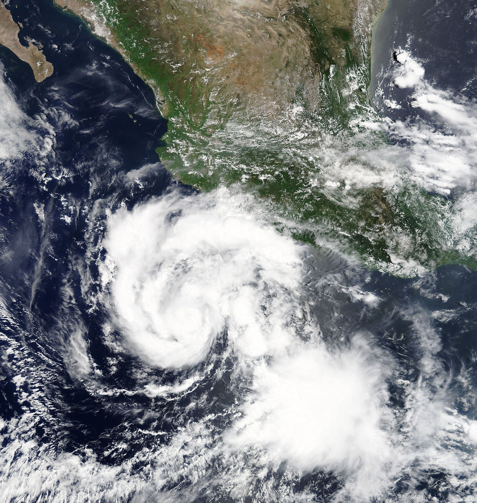
It all began when Hurricane Hilary formed as a tropical storm off the coast of Manzanillo, Mexico on August 16, 2023; however, between the 16th and the 17th, it quickly transcended from a tropical storm to a level 4 hurricane. It’s believed she began forming as a result of multiple components: El Nino (the name for warm water that develops in the central and east-central equatorial Pacific), climate change, a heat dome, and other factors.
As Hilary approached Mexico and the United States, cool ocean temperatures caused the hurricane to weaken. It made landfall on August 18 on Mexico’s Baja California Peninsula, and the government of Mexico issued a hurricane warning from Punta Abreojos to Punta Eugenia. Winds at this point had reached a high of 145 miles per hour. A couple days later on the 20th, it began to move into Southern California.
The hurricane weakened further into a tropical storm as it entered the U.S , promising heavy rain, high winds, and extreme flooding across the Western U.S. It gave Southern California its first tropical storm watch and warning since 1939, the last time a tropical storm occurred in the area. It also brought record breaking rain, over half a year’s worth coming down on Palm Springs alone. It drenched cities like San Diego and Los Angeles, as well as causing mudslides and landslides in multiple places recently burned by wildfires.
Tropical storms like Hilary that maintain strength are extremely rare in Southern California, due to the cool ocean temperatures and currents. Tropical cyclones need water that is at least 79 degrees Fahrenheit to develop and maintain strength. Sea surface temperature in the southern and central coast are typically 50 or 60 degrees due to cool ocean water brought from Alaska, courtesy of the California Current. Despite this, during the summer and early-September, it’s common to see them climb to the low 70s, which is why it is the most common time to see the remains of tropical storms.
In preparation for the storm, residents of Southern California took much precaution. Sandbags, loading up on supplies, and even preparing to lose power. Whatever was coming, they were as ready as they could be. Although they haven’t seen too many storms, they’ve had their fair share of earthquakes; a long time resident of San Fernando valley said that ¨preparedness is basically the set standard around here.¨
Although they did the best they could to prepare for Hilary, there were still damages, mudslides, and flooding left behind; in the words of a resident themselves, ¨When Mother Nature is unhappy, there’s only so much you can do about it.¨